
Welcome to the CaveRenderPro Homepage


After 20 years of development of the CaveRender cave surveying software,
CaveRenderPro has now also completed 10 years of intensive development.
The aim was to provide an even more powerful, yet simple and intuitive tool
for cavers, using the modern JavaFX development environment.


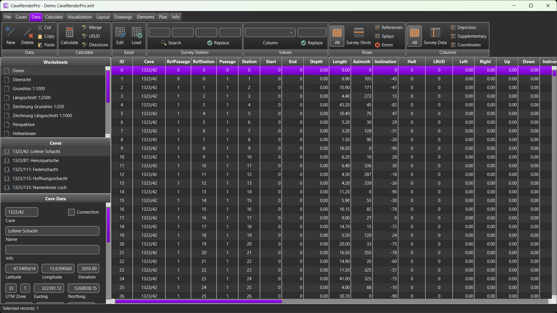
Examples
Reports
Features
- Completely new program structure with a more intuitive user interface
- Application runs in German, English, French and Czech
- Convenient installer for Windows (including Java and JavaFX)
- Light and dark mode
- User support via documentation, tooltips, demo files and Forum
- Loading of survey data from CaveRender (spreadsheet format),
Compass,
PocketTopo,
Qave,
SexyTopo, Therion,
TopoDroid,
Toporobot and VisualTopo
- Save all caves with GPS-coordinates to a single file
- Online query of declination and entrance altitude
- Survey data editor in tabular form (with integrated error checks)
- Alternatively: Edit the survey data in Excel
- Fore- and back-sight surveying, diving depth
- Automated survey analysis, loop closure and data reduction
- Survey shot filtering via level, passage, depth, date or selection
- Cave data visualization: plan, extended profile, projected profile,
perspective and volume visualization (convex and concave hull), maps (OpenTopoMap, CyclOSM,
Thunderforest, WorldImagery, basemap.at, swisstopo, Plan IGN – extendable with custom maps) and Google Earth
- North orientation (Geographic, UTM-Grid)
- Load and display contour lines
- Work sheets for data selection, visualization and layout
- Cave map drawing tools with background sketches (PocketTopo-DXF, TopoDroid-DXF, SexyTopo-SVG, Qave-SVG, point clouds and
bitmaps)
- Extensive drawing elements, UIS symbol database, random generated stones
and rocks
- Display of the drawings on the map
- Animations with an unlimited number of camera positions
- Screenshot of all graphics with legend
- Printing of plans to scale on multiple sheets
- Export of drawings as vector graphics in SVG and PDF format and overlays
in KMZ and PNG format
- Export: PocketTopo/VisualTopo, DXF-Format, Google Earth (KML), GPS devices (GPX), GeoJSON, 3D models (GLB) and QR codes
Legal disclaimer
CaveRenderPro is a
private project. It comes without warranty. Liability is excluded. Commercial
sales and use are
not permitted.
Activation
The printing and export of SVG, PDF, KMZ, PNG and GLB files requires an activation. If you have any questions, please send an email to
Jochen Hartig.
Download-Area
 CaveRenderPro including demo files:
Windows-Setup or
Zip-FIle
 CaveRenderPro-Documentation
 CaveRenderPro-Release
Notes
 CaveRenderPro-Forum
 Cave symbols for Garmin-GPS: Garmin.zip
 DAV Höhlengruppe
Frankfurt/Main
 Imprint


